Pálava Hills Routes: Wine Country Trails
Three popular loops through protected landscape with vineyards and historical sites. Each route takes 2-4 hours and rewards you with panoramic views across the region.

Why Pálava Matters for Hikers
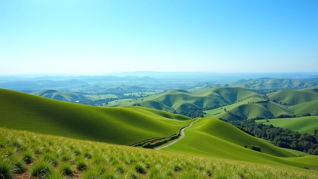
Pálava Hills sit in the heart of Moravia’s wine region, about 50 kilometers south of Brno. They’re not the tallest peaks you’ll find in Czech Republic — the highest point tops out around 450 meters — but what makes them special is the combination of natural beauty and cultural heritage packed into a relatively compact area.
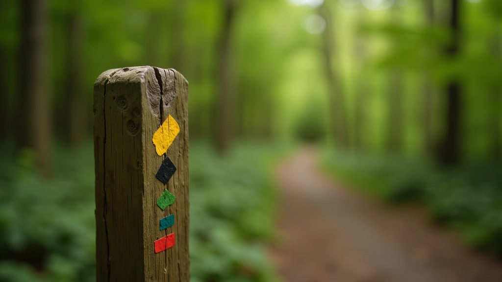
The protected landscape designation means the trails are well-maintained and clearly marked. You won’t deal with overgrown paths or confusing junctions. Plus, the region’s long history of wine production means villages along the routes have character. You’ll pass through places where families have been tending vineyards for generations.
Quick Facts
- Best season: May through September
- Elevation gain: 200-350 meters per route
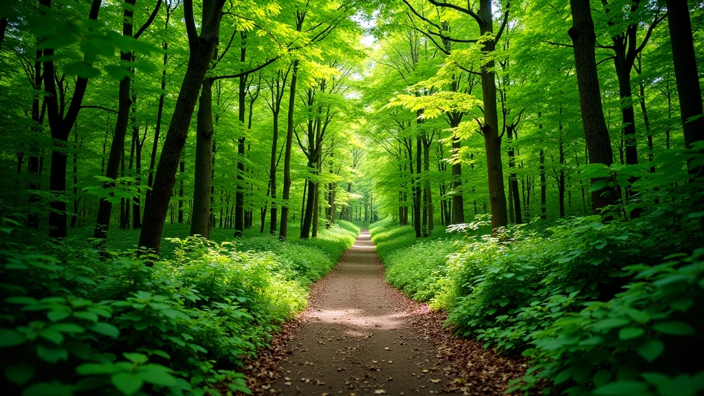
- Terrain: Mix of forest paths and open ridges
- Starting point: Mikulov or Lednice villages
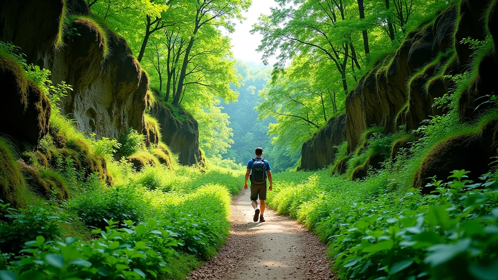
The Mikulov Loop: Wine & Views
The Mikulov loop is probably the most popular route in the area. It starts from the historic town of Mikulov — you’ll recognize it by the castle sitting on a hilltop — and takes roughly 3 hours for most hikers. The trail climbs steadily through vineyards in the first half, then opens up onto a ridge where you can see across the border into Austria on clear days.
What makes this route work is the pacing. You’re not constantly climbing — the ascent is spread across about 5 kilometers. That means you can actually enjoy the vineyard views instead of just staring at your feet. The descent on the back half uses an older forest path that’s shaded and feels properly remote despite being close to civilization.
“The ridge section around kilometer 8 is where you realize why this route gets recommended so much. The panoramic view extends for about 40 kilometers in every direction.”
Most hikers finish by mid-afternoon, which gives you time to explore Mikulov’s old town. There are wine cellars you can visit — some are small family operations, not fancy tourist traps — and decent restaurants if you want something more substantial than a snack.
The Lednice Circuit: Easier & Quieter
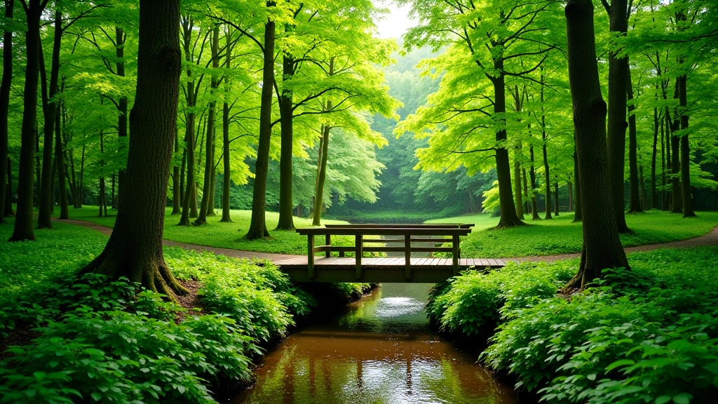
If the Mikulov loop sounds like more elevation than you want, the Lednice circuit is a solid alternative. It’s about 2.5 hours, with roughly 150 meters of elevation gain — manageable for most fitness levels. The trail stays lower in the landscape, mixing vineyard sections with forest paths.
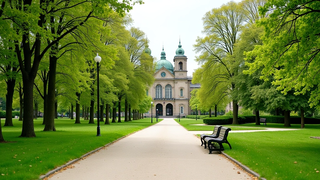
Lednice itself is worth the trip. The village centers around a stunning baroque palace and park complex — basically a castle estate surrounded by managed grounds. You won’t hike through the palace grounds, but you’ll see it from several points on the trail, and it creates nice visual landmarks for navigation.
The route attracts fewer hikers than Mikulov, so if you prefer quieter trails, this one’s worth considering. You’ll still encounter other people — it’s a popular region — but you won’t feel crowded. The trail is well-marked with standard Czech hiking signs (usually colored blazes on trees).
One practical advantage: the Lednice route has better water access. There’s a village tap at the midpoint, and several cafes if you need a longer break.
The Pálava Traverse: Challenge Route
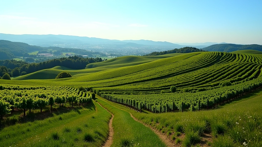
If you’re looking for something more ambitious, the Pálava Traverse connects multiple peaks across the protected area. It’s roughly 15 kilometers and takes about 4-5 hours depending on your pace and how many stops you make. The elevation gain is significant — around 450 meters total — but it’s distributed across the whole route rather than concentrated in one section.
This route requires better navigation skills than the two loops above. While the path is marked, there are a few junctions where you need to pay attention. We’d recommend downloading an offline map or printing one beforehand. The Czech hiking app Mapy.cz is excellent for this — it’s free and incredibly detailed.
What makes the traverse worthwhile is the variety. You’ll move through multiple habitat zones — from open vineyard ridges to dense forest sections to limestone grassland areas. The landscape changes enough that it doesn’t feel monotonous. You’re also less likely to encounter tour groups on this route, which tends to be popular with serious hikers rather than casual day-trippers.
Practical Details That Actually Matter
Getting There
Mikulov and Lednice are both accessible by bus from Brno (about 50 kilometers away). Train service exists but isn’t as convenient. If you’re driving, there’s parking in both towns — Mikulov has paid parking near the castle, Lednice has free spots closer to the village center. We’d recommend arriving early if you’re going on a weekend.
What to Bring
Proper hiking boots matter here more than on some easier trails — the terrain includes rocky sections and can be slippery when wet. Bring 1.5-2 liters of water even though there are village taps. The sun exposure on the ridge sections is real, so sunscreen and a hat aren’t optional. A light layer is useful for the forest sections where it’s cooler.
Timing & Seasons
Spring (May-June) and fall (September-October) are genuinely the best times. Summer can get hot on exposed ridge sections, and winter weather makes the limestone trails genuinely slippery. The vineyard areas are beautiful in September when grapes are ready for harvest — you might even encounter harvest crews working in the fields.
Where to Stay
Both Mikulov and Lednice have guest houses and small hotels. They’re not luxury operations, but they’re clean and reasonably priced. Mikulov tends to be busier and more touristy. If you want something quieter, Lednice or one of the smaller villages like Pavlov work well. Book ahead during peak season (June-September).
Things Hikers Actually Wish They’d Known
The limestone sections drain fast but get slippery when wet
Pálava is built on limestone, which means trails dry quickly after rain but become genuinely slippery when wet. We’re talking careful footing slippery, not just annoying. If there’s been rain in the past 24 hours, you’ll want to move slowly on the steeper sections.
Start early to avoid the afternoon heat
The ridge sections have almost no shade. Starting at 7 or 8 AM means you’ll be in the exposed areas during the cooler morning hours. By the time the sun is directly overhead, you’re back in the forested sections. Start at noon and you’re hiking the hardest parts in peak heat.
Download maps before you leave your hotel
Cell service is decent but not guaranteed everywhere. The Mapy.cz app lets you download offline maps for free. Takes 2 minutes and prevents navigation stress. Print a map too if you’re not comfortable reading a phone while hiking.
The wine stops are real but plan your timing
Yes, you can visit wine cellars along the routes. Many are actually open to visitors. But they’re not located right on the trails — you’d need to detour into villages. Plan to do this at the end of your hike when you’re not trying to maintain a schedule. The tasting portions are small and genuinely interesting if you like wine.
Wrapping Up: Why These Routes Work
The Pálava Hills aren’t the most challenging hikes in Czech Republic, and they’re not the most remote. What they are is consistently good. The trails are maintained, the scenery rewards the effort, and the villages add cultural dimension that pure nature-hiking sometimes lacks.
Whether you pick the easier Lednice circuit, the classic Mikulov loop, or the more ambitious traverse depends entirely on your current fitness and what you want from the day. All three are legitimate routes that deliver. Most hikers we’ve talked to end up coming back to explore different combinations.
The best approach is to pick one route for your first visit, get familiar with the landscape, then come back to try another. You’ll notice different details on each pass, and the seasonal changes mean the same trail feels completely different in May versus September.
Important Note
This guide is intended for informational purposes to help you understand the routes and terrain in the Pálava Hills protected area. Hiking conditions, trail accessibility, and local regulations can change due to weather, maintenance, or administrative updates. We recommend checking current trail conditions with local tourism offices before your visit. Always follow trail markers, bring appropriate safety equipment, and let someone know your planned route. Hiking involves inherent risks — assess your own fitness level and experience before attempting any route described here.
Explore More Trails in Czech Republic